Kepayang Hill or Bukit Kepayang is a small hill area (205 meter above sea level) in Seremban, next to another hiking spot which is Bukit Bal. Even though it is just a small area, exploring all the subtrails here could take hours with high elevation gain due to going up and down the small hill.
🌟 TRAIL INFO ~ Bukit Kepayang Trailhead via Seremban S2 Hill Park GPS : 2.712080801252823, 101.89558020626761 ~ Difficulty Level - moderate ~ Distance - 11km (return) ~ Elevation Gain 600M ~ Entrance fees - No for the time being
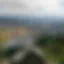
Kepayang Hill with the height of 218 meter located in Taman Bukit Kepayang, Seremban. It is one of the famous local hiking place which usually takes 10~30 minutes to the peak with 360 degree great view of Seremban and S2 area. Thanks for the Kepayang Hill Committee with their great work for maintaining and developing the trails.
Gunung Angsi is probably the second most popular mountain in Negeri Sembilan, if Gunung Datuk takes the first spot. Mount Angsi is an easy to moderate hike suitable for casual hikers and fit beginners, that is if you take the Bukit Putus route. The least popular Ulu Bendul route is certainly more difficult than the crowd’s favorite Bukit Putus route.
Rigger Hill located in Bukit Putus next to Gunung Angsi Negeri Sembilan with the height of 560.5 meter a.s.l. I came across to know this mountain two years back before the first MCO. Knowing that beside Ulu Bendol and Bukit Putus trails, there are two more trails could link up to Gunung Angsi peak as well. Rigger hill is one of it which link up to Bukit Putus trail signboard (18 minutes to go).
The trail is clear with marking leading you to the Bukit Temiang peak. The are many junctions in between and you got to know your direction well or go with GPS trail for reference. From Bukit Temiang to Bukit Simpang it tooks us approx. 35 minutes