Mountain in Selangor

Gunung Nuang
🏛️ Attraction Hiking TrailSportAdventureMountainNatureCampsite
Famous but strenuous hiking spot in Selangor.


Bukit Unyang
🏛️ Attraction NatureMountainHiking TrailSportAdventure

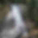


Trailhead - Air Terjun Tujuh Puteri dan Bukit Permata
🏛️ Attraction Hiking TrailSportAdventureWaterfallNatureMountain


Bukit Chorocho
🏛️ Attraction MountainNatureHiking TrailSportAdventure